You are here: Wiki>SensorWeb Web>SensorPlatformFramework>KmlOutputPlugin (21 Jun 2012, DanielNuest)Edit Attach
KmlOutputPlugin
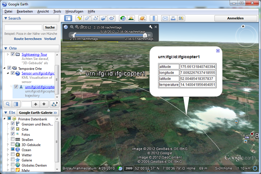
The KML Output-Plugin for the SPF provides live sensor visualization in Google Earth. The implementation uses kml:NetworkLink instances to refer to constantly updating KML resources. In combination with the FTPUploadExtension, this plugin is a powerful real-time data visualisation tool.
Current implementation
The current realization of the KmlOutputPlugin uses a static root to reference multiple Input-Plugins as sensors. Every sensor is represented as a dedicated document which itself links to another document containing the actual data. This way, the genral plugin architecture is represented as a hierarchy with multiple kml:NetworkLink sinks.
Enhancements
Data is represented using gx:Track currently. Nevertheless, KML does not provide a mechanism to update the Timeslider of Google Earth. Though the user has to manually start the timeslider animation to actually visualized the data. Future plans focus on developing an enhanced representation which allows a correct real-time behavior.Notes and Ideas
- Create GUI to enable styling of data representations and to meet other user-specific needs
- Integrate with SensorVis, as an output of the interpolations in a KML file. Essentially reproduce output that is shown in SensorVis in Google Earth via KML
- Add option to upload the files to some server (e.g. FTP protocol) automatically so that one essentially has a "onlive live" SensorVis, test to run SensorVis and SPF as a service component.
Development
Tasks
- See if the problems with reloading files or the timeslider updates can be fixed by using the proper update mechanism: https://developers.google.com/kml/documentation/updates, although one has to first find out if update can also add elements, not only change them.
Metadata
- Topic created by: DanielNuest
- Topic created on: 2011-12-20
| I | Attachment | Action | Size | Date | Who | Comment |
|---|---|---|---|---|---|---|
| |
kml-op.png | manage | 751 K | 22 May 2012 - 14:12 | UnknownUser |
Edit | Attach | Print version | History: r6 < r5 < r4 < r3 | Backlinks | View wiki text | Edit wiki text | More topic actions
Topic revision: r5 - 21 Jun 2012, DanielNuest
Legal Notice | Privacy Statement
 Copyright © by the contributing authors. All material on this collaboration platform is the property of the contributing authors.
Ideas, requests, problems regarding Wiki? Send feedback
 Copyright © by the contributing authors. All material on this collaboration platform is the property of the contributing authors.
 Ideas, requests, problems regarding Wiki? Send feedback


