GeoAR
About
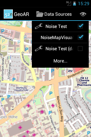
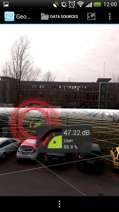
GeoAR is an (augmented reality) browser for geospatial data for the Android operating system. Its first version is based on a thesis in the context of OpenNoiseMap, which implemented clustering and visualisation of in-situ noise measurements using OpenGL ES, but that was extensively re-implemeneted and a lot more functionality added. GeoAR is developed within the project GeoViQua. It consists of three components:- GeoAR app
- GeoARDatasources - a flexible plug-in mechanism to add you own data
- GeoARCodebase - GeoAR's repository for data source plugins, see GeoARCodebase.
Features
- Browse geographic information on a map and in augmented reality
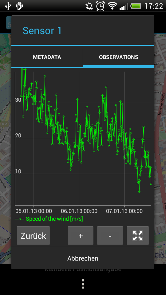
- See time series data provided by OGC Sensor Observation Services
- Plugin-mechanism for user developed data sources (GeoARDatasources)
- Open source (Apache 2.0)
App Screenshots


App Download and Installation
Download GeoAR from the Market: https://play.google.com/store/apps/details?id=org.n52.geoar Download and build the sources: GeoARDevelopmentApp Releases
Version 0.5.3 - Published 2013-03-26
-
Feature: Android 2.3.3 support
Version 0.5.2 - Published 2013-03-01
-
Fixed: Expanding Data Source group via expander icon was not possible
Version 0.5.1 - Published 2013-02-26
- Fixed: Some devices crashed after downloading an external data source plugin
- Fixed: Some devices could not display content provided by external data sources
Version 0.5 - Published February 2013
- first alpha version
Source Code
Source code is available under Apache License 2.0 from the 52°North GitHub. The app's source code repository is at https://github.com/52North/geoar-app. You can download the code with the following git command:git clone https://github.com/52North/geoar-app.git
There are several related projects:
- https://github.com/52North/geoar-datasources - a collection of data sources
- https://github.com/52North/geoar-ds - API and common classes for implementing datasources
- https://github.com/52North/geoar-codebase - a server application providing access to versioned plugins for data retrieval
Literature and other work
Interesting external resources and publications about current augmented reality developments.- A Proposal For Reference AR System Architecture Based On Stadardized Content Model von Gerard Kim, Youngsum Kim und Chrstine Perey
- http://www.perey.com/ARStandards/%5BKim,Perey%5DAR_Architecture_Survey_ISO-JTC1.pdf
- two architecture parts
- interpreting and transforming content (to abstract scene model)
- mapping the digitally rendered components to the screen
- architecture and technology overview as of July 2011
- interim report, feedback requested
- A Proposed Step-By-Step Guide to qn AR Standard by Martin Lechner
- http://www.navteq.com/outdoor_mar2011/ar_standards_position_paper.pdf
- Short version: http://www.perey.com/ARStandards/%5BEDINA%5DMobile_AR_Architectural_Styles.pdf
- position paper on AR by Wikitude
- guideline for ARML 2.0 SWG, defining a reasonable scope for an AR standard
- architecture analysis
- Augmented Reality For Smartphones by Ben Butchard (EDINA) for JISC Observatory
- A Guide for developers and content publishers
- http://observatory.jisc.ac.uk/docs/AR_Smartphone_final.pdf
- Updated comparison table at http://mobilegeo.wordpress.com/2010/11/23/comparing-ar-browsers/
- State-of-the-art report March 2011, educators somewhat targeted, see concluding remarks
- EXTENSIVE!
- Browsers, http://mobilegeo.wordpress.com/2010/11/23/comparing-ar-browsers/ has updated comparison table
- Authoring and Publishing Tools
- Standards, Tools and Best Practice Guidelines
- User Experience Design and Anti-Patterns
- Augmented Reality in Education
- Architectural Styles for Augmented Reality in Smartphones by Ben Butchart (see also report above)
- http://mobilegeo.wordpress.com/2011/06/18/architectural-styles-for-augmented-reality-for-smartphone/
- http://www.perey.com/ARStandards/%5BEDINA%5DMobile_AR_Architectural_Styles.pdf
- architectures across browsers/SDKs fairly consistent but important differences
- six logical subsystems for AR: tracking, application, world model, presentation, context, interaction
- faily high-level, compares this to existing AR browsers
- "gateway pattern"
- "web architecture"
- "standalone architecture"
- faily high-level, compares this to existing AR browsers
- http://www.perey.com/ARStandards/third-meeting-position-papers-and-pre-reads/
- Augmented Reality & GIS: html
- ARViewer / LibreGeoSocial: http://www.libregeosocial.org/node/26, GPLv3 license
- Bloomberg Innovators Episode 6: Augmented Reality (four videos): http://www.youtube.com/watch?v=86wnGrJpaCo&feature=relmfu (featurung Metaio (with LEGO and Adidas), Georgia Tech, ARNY meetup, ...)
- NASA World Wind is available in an Android version:http://goworldwind.org/android/ (download)
- Broadcom Locationing Chip: http://heise.de/-1518466
- "GIS and AR is coming...": DS2011: Augmented Reality using ArcGIS and Layar http://resources.arcgis.com/de/gallery/video/arcgis-for-ios/details?entryID=CA9F541A-1422-2418-88FA-E7DAC681E831
- Augmented reality apps may generate USD 300 mn in 2013 (Published Date : 12 November 2012) US: A new report from Juniper Research has found that augmented reality (AR) mobile apps market is expected to generate USD 300 mn revenue in 2013, with companies and retailers keen to use AR in the apps and marketing materials. http://mobility.cbronline.com/news/augmented-reality-mobile-apps-to-generate-300m-revenue-in-2013-report-071112
- "Prosumers" can be confronted with uncertainty of information (inspired by Schiewe's talk at GeoViz 2013)
| I | Attachment | Action | Size | Date | Who | Comment |
|---|---|---|---|---|---|---|
| |
Screenshot_2013-02-18-12-00-19.png | manage | 428 K | 27 Feb 2013 - 09:16 | UnknownUser | |
| |
device-2012-11-30-163009.png | manage | 82 K | 04 Feb 2013 - 13:37 | UnknownUser | |
| |
device-2013-01-09-172244.png | manage | 155 K | 04 Feb 2013 - 13:37 | UnknownUser | |
| |
device-2013-01-09-172300.png | manage | 233 K | 04 Feb 2013 - 13:37 | UnknownUser |
Edit | Attach | Print version | History: r78 < r77 < r76 < r75 | Backlinks | View wiki text | Edit wiki text | More topic actions
Topic revision: r77 - 19 Aug 2014, danielnuest
Legal Notice | Privacy Statement
 Copyright © by the contributing authors. All material on this collaboration platform is the property of the contributing authors.
Ideas, requests, problems regarding Wiki? Send feedback
 Copyright © by the contributing authors. All material on this collaboration platform is the property of the contributing authors.
 Ideas, requests, problems regarding Wiki? Send feedback


