You are here: Wiki>SensorWeb Web>ArcGISServerSOSExtension (23 Mar 2015, matthesrieke)Edit Attach
ArcGISServerSOSExtension
Page contents
Configuration
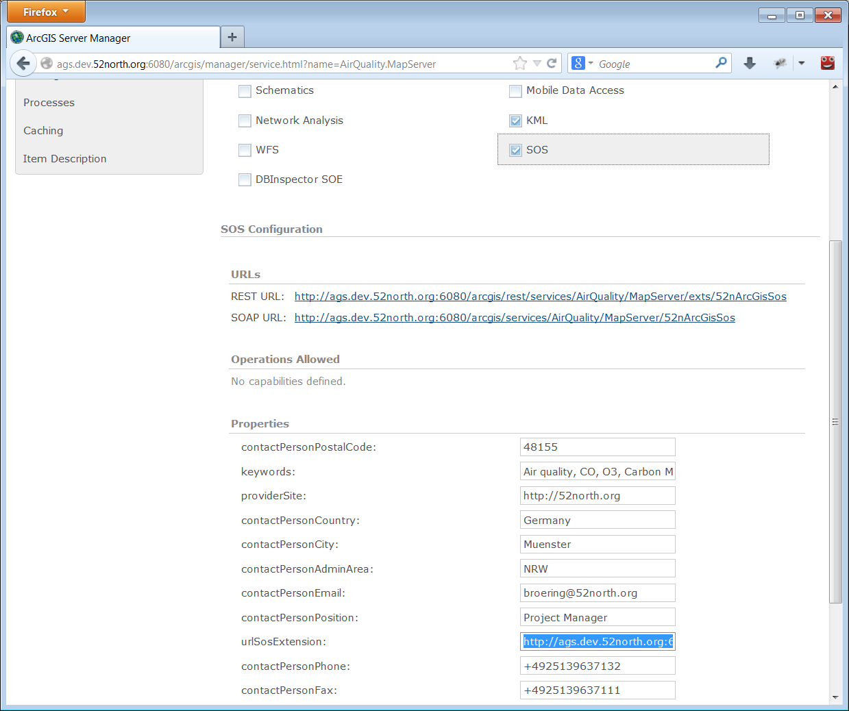
The extension needs to have a set of paramters defined in order to create a correct Capabilities document. Configure the following parameters through ArcGIS Server Manager:- urlSosExtension = the globally known URL of the extension. This acts as the base URL of the resulting operations in the Capabilities
- ...
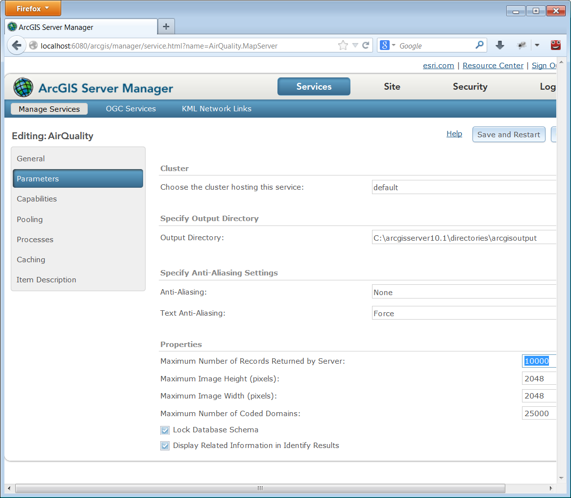
 The maximum number of returned measurements can be defined in the parameters of the Service (not the extension). If a query exceeds the defined "Maximum Number of Records Returned by Server" an OWS Exception will be thrown by the service.

Downloads
Airquality_E1a_Germany.zip: sample SQL Server database ArcGIS-Server-SOS-Extension-1.1.0.zip: ArcGIS-Server-SOS-Extension Version 1.1.0 Release| I | Attachment | Action | Size | Date | Who | Comment |
|---|---|---|---|---|---|---|
| |
Airquality_E1a_Germany.zip | manage | 5 MB | 04 Mar 2015 - 14:33 | UnknownUser | sample SQL Server database |
| |
ArcGIS-Server-SOS-Extension-1.1.0.zip | manage | 2 MB | 23 Mar 2015 - 13:31 | UnknownUser | |
| |
ags-manager-properties-2.png | manage | 101 K | 05 Aug 2013 - 10:50 | UnknownUser | |
| |
ags-manager-properties.png | manage | 80 K | 02 Aug 2013 - 08:12 | UnknownUser |
Edit | Attach | Print version | History: r5 < r4 < r3 < r2 | Backlinks | View wiki text | Edit wiki text | More topic actions
Topic revision: r4 - 23 Mar 2015, matthesrieke
Legal Notice | Privacy Statement
 Copyright © by the contributing authors. All material on this collaboration platform is the property of the contributing authors.
Ideas, requests, problems regarding Wiki? Send feedback
 Copyright © by the contributing authors. All material on this collaboration platform is the property of the contributing authors.
 Ideas, requests, problems regarding Wiki? Send feedback


