|
|
You are here: Wiki>Projects Web>EnviroCar>EnviroCarArcMapClient (05 Sep 2014, BenjaminPross)Edit Attach
ArcMap Client using enviroCar data and processes
About
If you are used to using ArcMap, you can analyse enviroCar data directly in your familar GIS using the 52°North Extensible ArcMap Client. All you need is the Extensible Client and an extra data transformation tool (see the Download section for detailed information). In the following we will show how to use the client with enviroCar data. We will compute the total number of stops (speed smaller than a specified value) at specified points of interest.Walkthrough
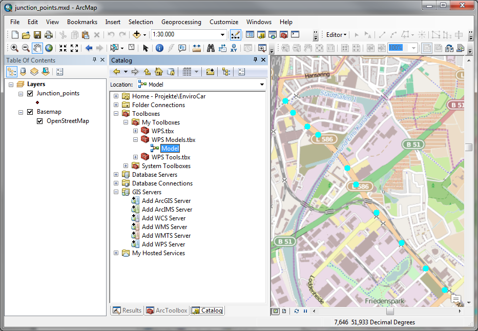
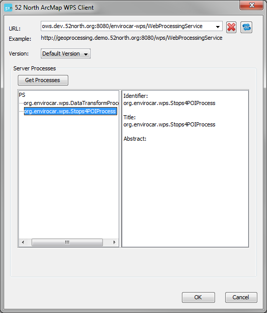
After you have installed the Extensible Client and the extra tools, you should see a new icon in the GIS Servers tree in the Catalogue window. A double click will open the WPS client: Enter http://ows.dev.52north.org:8080/envirocar-wps/WebProcessingService in the URL field and click "Get Processes".
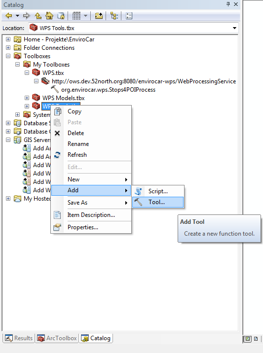
 Select the org.envirocar.wps.Stops4POIProcess and clock "OK". The process will be wrapped in a ArcMap geoprocessing tool in a toolbox called "WPS".
 To transform the data from the format used in ArcMap to a format that the WPS can handle (and vice-versa), additional tools are needed. The different tools are then connected via the model builder. We would recommend to add two new toolboxes named "WPS Tools" and "WPS Models".
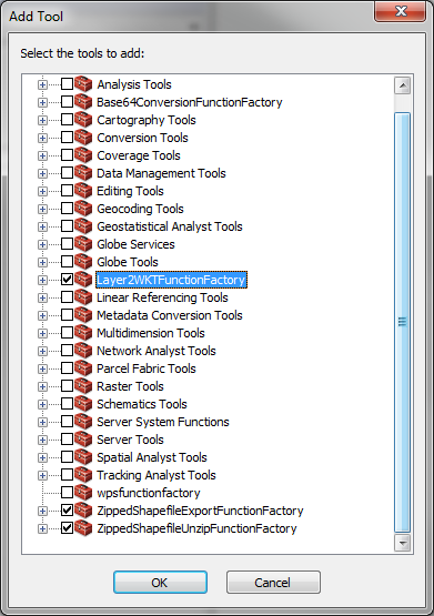
 Now we need to add the data transformation tools. Right click on the "WPS Tools" toolbox and select "Add -> Tool...". For the enviroCar data we need two transformation tools, the layer to well known text tool (Layer2WKT) and the zipped shapefile unzip tool(ZippedShapefileUnzipTool). Check the respective boxes and click "OK":
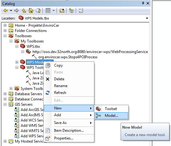
 Now we need to connect the tools. Add a new model to the "WPS Models" toolbox:
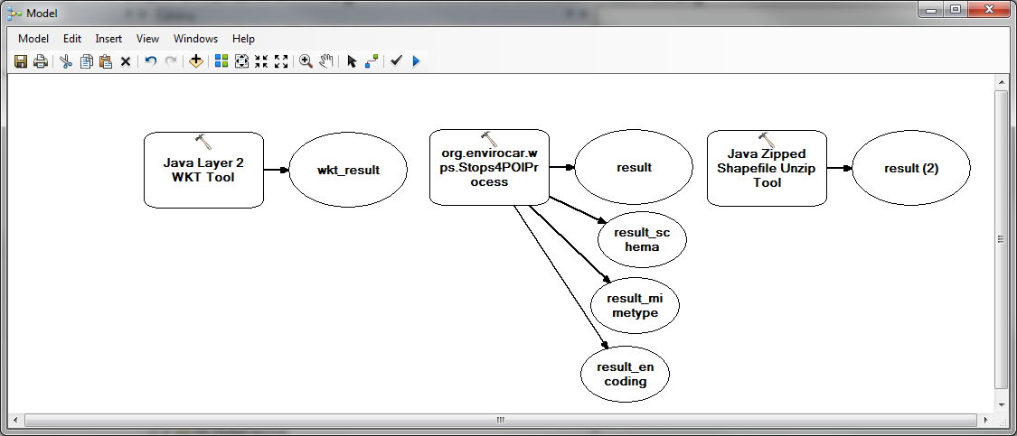
 Drag the org.envirocar.wps.Stops4POIProcess, the Layer2WKTTool and the ZippedShapefileUnzipTool onto the modelling area:
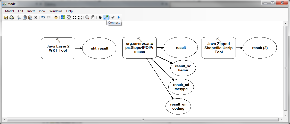
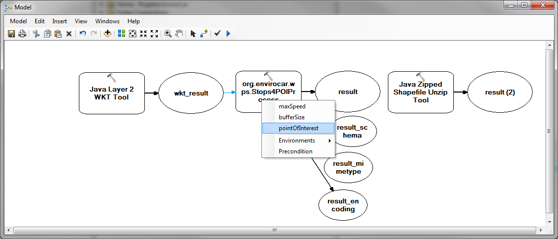
 Use the "Connect" button to create the following connections: wkt_result with pointsOfInterest, as shown below:
 Also connect the result output of the Stops4POIProcess with the Input Filename input of the ZippedShapefileUnzipTool and result_schema, -mimetype and -encoding of the Stops4POIProcess with the respective inputs of the ZippedShapefileUnzipTool.
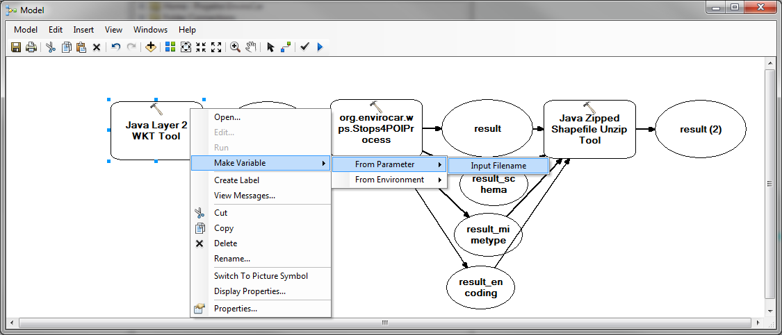
Now we need to declare some model variables (inputs and outputs). Declare the Input Filename input of the Layer2WKTTool as a variable as shown below (right click on tzhe Layer2WKTTool first):
Also connect the result output of the Stops4POIProcess with the Input Filename input of the ZippedShapefileUnzipTool and result_schema, -mimetype and -encoding of the Stops4POIProcess with the respective inputs of the ZippedShapefileUnzipTool.
Now we need to declare some model variables (inputs and outputs). Declare the Input Filename input of the Layer2WKTTool as a variable as shown below (right click on tzhe Layer2WKTTool first):
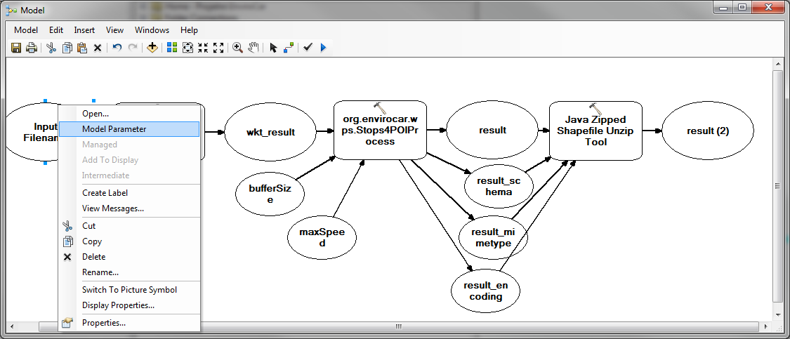
 Now make variables out of the maxSpeed and bufferSize inputs of the Stops4POIProcess and out of the result (2) output of the ZippedShapefileUnzipTool. Make the newly created variables model parameters (right click on the variable):
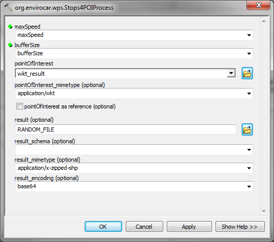
 Now we need to specify some parameters in the Stops4POIProcess. Double click the tool and set the drop boxes of the pointOfInterest_mimetype, result_mimetype and result_encoding as shown below:
 Now you can save the model. Now it is time to add some data. For this walkthrough we created a point layer containing several locations of crossroads. Note that the reference system currently has to be EPSG:4326 (GCS_WGS_1984).
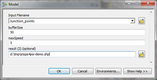
 Select the points you are interested in. We now can execute the Stops4POIProcess model. Double click the model to bring up the following dialog:
 Choose the point layer for the Input Filename. Fill out the rest of the in-/outputs at your discretion. A click on "OK" will start the process.
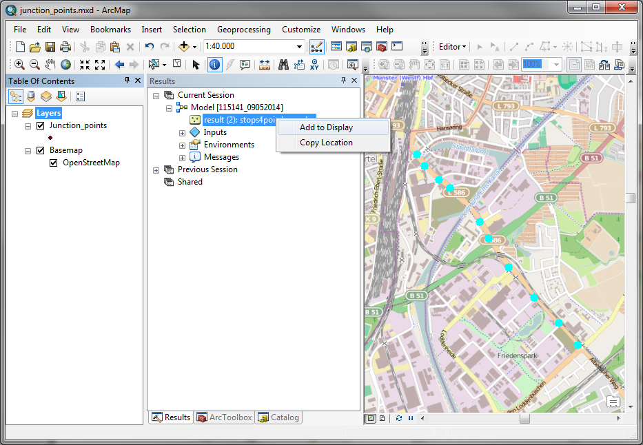
After successful execution, switch to the results tab and add the result to the display:
Choose the point layer for the Input Filename. Fill out the rest of the in-/outputs at your discretion. A click on "OK" will start the process.
After successful execution, switch to the results tab and add the result to the display:
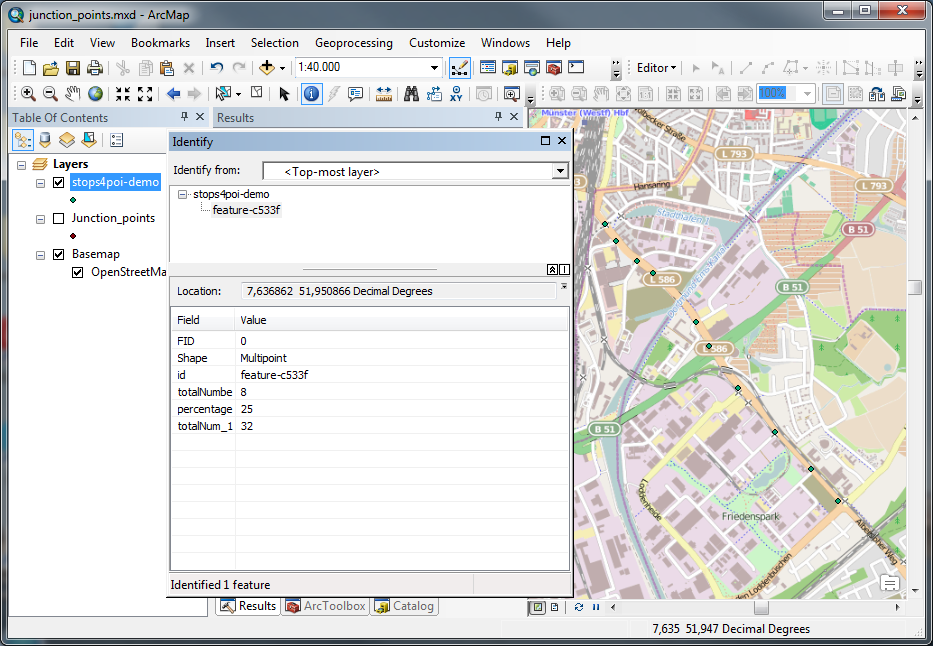
 You can examine the results using the identify tool:
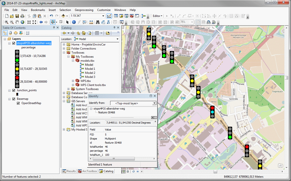
 You could also classify the result:

Code
The soruce code of the Extensible WPS ArcMap Client is located in our SVN repositories. Please refer to Benjamin Pross to gain access.Download / Installation
The client can be downloaded from here: 52°North Extensible WPS ArcMap Client. The additional data transformation tools can be downloaded from here: Layer2WKTTool. You will need to unzip the two files in the /java/lib/ext sub-directory of your ArcMap installation, e.g. "C:\Program Files (x86)\ArcGIS\Desktop10.1\java\lib\ext".Contact
Community mailing list: subscribe with email, web-based forum Benjamin Pross

Edit | Attach | Print version | History: r3 < r2 < r1 | Backlinks | View wiki text | Edit wiki text | More topic actions
Topic revision: r2 - 05 Sep 2014, BenjaminPross
- Toolbox
-
 Users
Users
-
 Index
Index
-
 Search
-
 Changes
-
 Notifications
-
 RSS Feed
-
 Preferences
- Webs
-
 AI_GEOSTATS
- Documentation
- GEONETCAST
- Geoprocessing
- Geostatistics
- Metadata
- Projects
- Sandbox
- Security
- Semantics
- SensorWeb
- System
- V3d
- Categories
Legal Notice | Privacy Statement
 Copyright © by the contributing authors. All material on this collaboration platform is the property of the contributing authors.
Ideas, requests, problems regarding Wiki? Send feedback
Ideas, requests, problems regarding Wiki? Send feedback