|
|
You are here: Wiki>AI_GEOSTATS Web>AI_GEOSTATSEvents>EventsSIC (02 Aug 2010, TheresiaFreska)Edit Attach
Spatial Interpolation Comparison (SIC) exercises
In Spatial Interpolation Comparison (SIC) exercises, participants are invited to estimate values of a variable at given locations by using information provided by a subset of the total number of measurements of the variable (see Figure 1). The algorithms of the participants are then contrasted with each other by comparing the estimation errors of each spatial interpolation technique. Participants are further invited to present their techniques in a manuscript that is reviewed by an editorial board prior to the publication of the exercise.
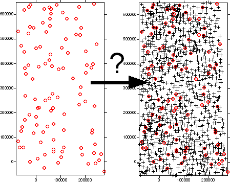 Figure 1. Spatial Interpolation Comparison (SIC) exercise: participants are invited to minimize errors when using n observations (left) to estimate values located at N locations (right).
Submitted manuscripts are expected to describe the technique used and their results. Among other information, the following information is usually requested:
Figure 1. Spatial Interpolation Comparison (SIC) exercise: participants are invited to minimize errors when using n observations (left) to estimate values located at N locations (right).
Submitted manuscripts are expected to describe the technique used and their results. Among other information, the following information is usually requested: - Mean Square Errors
- Mean Absolute Errors
- Statistics of the estimated values: Minimum, maximum, mean, median and standard deviation,
- Statistics of the errors: Minimum, maximum, mean, median and standard deviation.
- A map with the estimated values
- A map with the levels of uncertainty
Edit | Attach | Print version | History: r5 < r4 < r3 < r2 | Backlinks | View wiki text | Edit wiki text | More topic actions
Topic revision: r4 - 02 Aug 2010, TheresiaFreska
- Toolbox
-
 Users
Users
-
 Index
Index
-
 Search
-
 Changes
-
 Notifications
-
 RSS Feed
-
 Preferences
- Webs
-
 AI_GEOSTATS
- Documentation
- GEONETCAST
- Geoprocessing
- Geostatistics
- Metadata
- Projects
- Sandbox
- Security
- Semantics
- SensorWeb
- System
- V3d
- Categories
Legal Notice | Privacy Statement
 Copyright © by the contributing authors. All material on this collaboration platform is the property of the contributing authors.
Ideas, requests, problems regarding Wiki? Send feedback
Ideas, requests, problems regarding Wiki? Send feedback